History of Latin America
The Old New World
Lecture outline
Discussion: "Terra Preta" (film)
The political borders of modern Latin America have a deep history.
The Treaty of Tordesillas between Portugal and Spain in 1494 drew a vertical line at around 370 leagues (+/- 1770 km) west of the Cape Verde islands off the coast of Africa. Everything to the east was Portugal's, to the west, Spain's. In practice, as Indigenous peoples died or migrated and Europeans kept exploring, the line kept moving west.
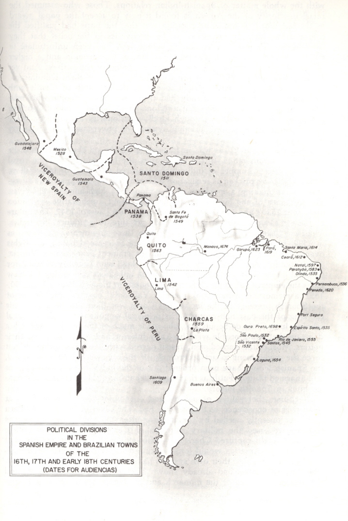
The Spanish established colonial citie in the heart of the Aztec and Inca empires,
which became the Viceroyalties of Mexico and Peru. You can see the outlines of some future countries in Spanish judicial districts called "Audiencias," for example, the Audiencia of Guatemala.
As Indigenous people died or migrated, invasive species -- not just European colonists but pigs, sheep, cattle, horses, and other animals as well as new plants took their place, transforming the landscape.
Some (but not all) Indigenous survivors retreated to more inaccessible areas, as did Africans escaping slavery.
Other European powers -- the British, French, Dutch, Scots, Scandinavians, etc. -- challenged the Spanish and Portuguese in the Caribbean and Atlantic especially. Florida, Cuba, Santo Domingo/St. Domingue, New Orleans, Guyana, Buenos Aires, and Honduras were all fought over and swapped between European powers.
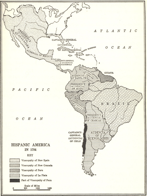
Treaties in the late 1700s gave the area around Río de la Plata to Spain, and most of Amazonia to Portugal.
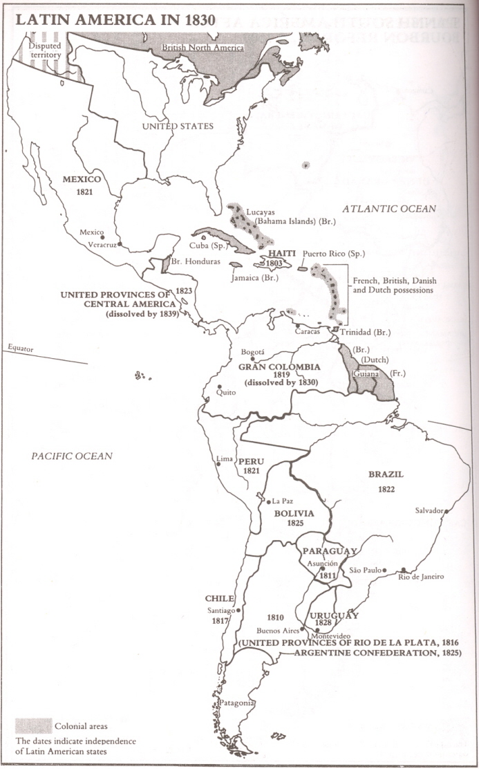
Also in the 1700s, Spain created new districts that separated New Granada (1739) and Río de la Plata (1776) from Peru. Venezuela (1777) and Chile (1778) became Captaincy Generals. These redrawn internal boundaries proved durable, as seen in maps of the new nation-states in 1830.
Notice that the 1830s maps show Bolivia with an outlet to the sea. This changed during the War of the Pacific (1879-83) between Chile, Bolivia, and Peru. Compare to today.
Map quiz next Tuesday!
You are responsible for the twenty nation-states listed on the map above and their capital cities,
PLUS the following selected physical features -- check out Content-Map Resources on D2L for more:
Yucatan peninsula (Mexico)
Andes mountains
Amazon River (Peru and Brazil)
Lake Titicaca (Peru and Bolivia)
La Plata River [Rio de la Plata] (Argentina)
Pampas (Argentina)
![[Map]](../../images/maps/sa-map.gif)