Click on the country of your choice on the map or on the printed list
![[Map]](../../sa-map.gif)
For the uncoordinated
Click on the country of your choice on the map or on the printed list
| ||
|
| For the uncoordinated
| |
| Argentina | Colombia | |
| Bolivia | Costa Rica | |
| Nicaragua | El Salvador | |
| Ecuador | Peru | |
| Panama | Honduras | |
| Guatemala | Venezuela | |
| Chile | Paraguay | |
| Uruguay | Mexico | |
| Brazil | Dominican Republic | |
| Puerto Rico | Cuba | |
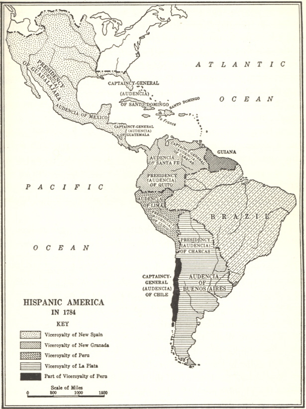
The boundaries of modern Latin American nations were unintentionally by Spanish and Portuguese reformers in the late colonial period. Compare the boundaries of 1600 to those established by the Bourbon reformers in the 1780s. As part of the Spanish King Charles III's attempt to regain political and fiscal control of the colonies, colonial officials separated New Granada (1739) and Rio de la Plata (1776) from Peru. They also elevated both Venezuela (1777) and Chile (1778) to the status of Captaincy General.
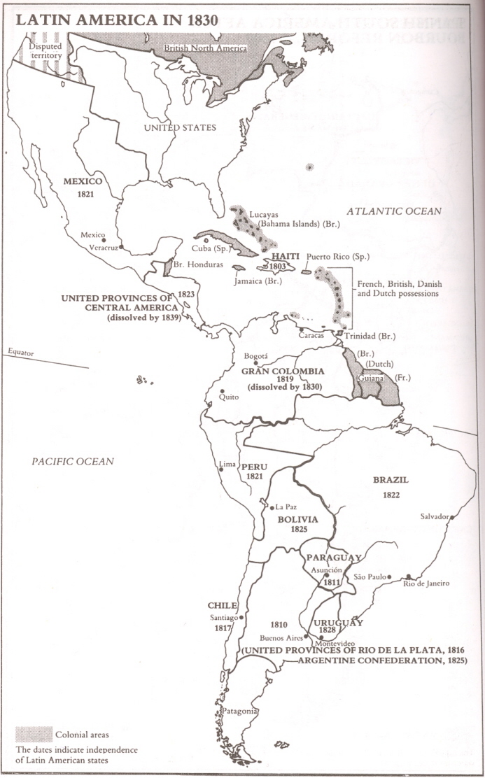
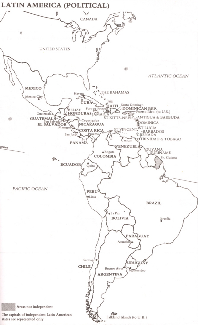
The redrawn political boundaries proved durable, as seen in maps of the new states of the 1830. Notice that the 1830s maps show Bolivia with an outlet to the sea; this changed in the 19c during the War of the Pacific (1879-83) between Chile, Bolivia, and Peru. Compare to today.
You should be able to identify on a map the twenty nation-states listed on the map above and their capital cities, in addition to the following selected physical features:
Yucatan peninsula (Mexico)
Magdalena River (Colombia)
Orinoco River (Venezuela)
Andes mountains
Amazon River (Peru and Brazil)
Lake Titicaca (Peru and Bolivia)
La Plata River [Rio de la Plata] (Argentina)
Pampas (Argentina)